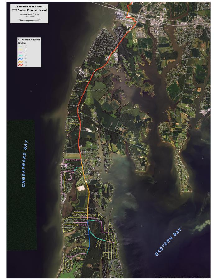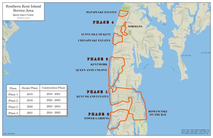
Maps
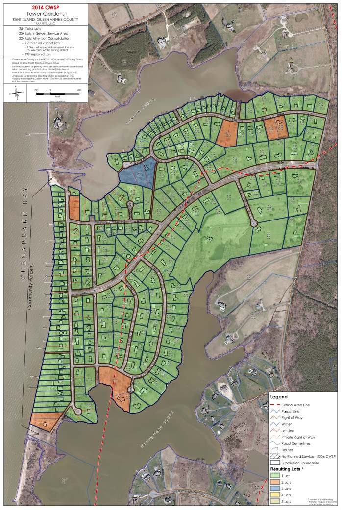
Individual Community Lot Merger Maps
These maps should not be interpreted as being the final determination of the impacts of Ordinance 13-24, aka the Lot Merger Ordinance, on the affected subdivisions. Minor inconsistences in the way the deeds’ data was entered into the State Department of Assessment and Taxation database, which was used by a GIS algorithm to generate these maps, may lead to depict two adjacent lots as being owned by two distinct owners when in fact they are owned by the same owner, and therefore subject to mandatory merger. Examples being the use of ‘and’ on one deed, and ‘&’ on the adjacent lot’s deed, or the use of “William” on one deed and “Wm” on the lot adjacent. Verification of these situations must be directed to the County for interpretation.